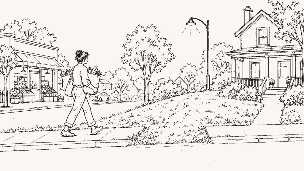
You are deciding whether this neighborhood earns a spot on the short list you will spend a scouting trip on. You are deciding that from a kitchen table six hundred miles away, before you have stood on the street, and the method has to respect that distance instead of pretending it away.
Remote research does one thing well. It eliminates. A neighborhood that puts your office fifty minutes out at 7:40 and sits in a mapped floodway can come off the list tonight, and you never buy the plane ticket. What remote research cannot do is approve a place. Every answer you gather from here is a record of something, a report by someone with an interest, a model’s estimate, or one person’s Tuesday. The work is keeping those piles separate so you know, at the end, what you have on record and what is still yours to check.
Build the ledger before you open a portal
Start a document with one row per question and four columns: the question, the answer, where the answer came from, and what kind of answer it is. The fourth column takes one of five labels. Official record means a government, district, county, regulator, or utility said it. Provider-reported means the business that sells the service said it, and the business has a reason to say it. Estimate means a model or a map calculated it. Local observation means a person who lives there told you, and you wrote down who. Personal verification means you check it yourself, at the address. Nothing else counts for that row.
The ledger is the part of this process a portal cannot give you. A listing page mixes all five kinds of information into one confident paragraph, and the confidence is the problem. When the tax figure, the “walkable” badge, the school rating, and the “quiet street” line all sit in the same font, you stop asking which one is a record and which one is a guess. The ledger forces the question on every row. It also costs evenings, and a neighborhood that looks fine after three rows may look wrong after twelve, which is the point, and also why people skip it.
Everything below is a set of rows for that ledger.
Run the five places at the real hour
Write down the five places you will reach most often from this address: the employer, the grocery store you would actually use, the school, the clinic, the parent or friend you will drive to on Sundays. Find the real street address of each one. Then run the drive in a mapping tool with a departure time set to the hour you would leave, in both directions, on a weekday. A route that reads 24 minutes at noon on Sunday can read 41 at 7:40 on Tuesday, and the tool will show you both if you ask for both.
Label every one of those numbers Estimate. A traffic-model time is a prediction built from other drivers’ recent trips, and it does not know about the school zone that adds nine minutes in September or the bridge that closes for repainting. The number looks precise, which is the risk. It is good enough to strike a neighborhood that fails badly, and it is the reason you take the trip, since the only commute you can trust is the one you drive. The full version of this test, including what to do when three of the five places sit in three directions, is in The Five-Places Test: Can This Neighborhood Actually Support Your Week?.
Find out what the address feeds into
Three lookups fill the next three rows. Each answers one narrow question.
School assignment comes from the district, and a rating site does not carry it. Many districts publish an attendance-boundary lookup on their own site; enter the street address and record which elementary, middle, and high school it returns. That is an Official record. If the district has no lookup, call its enrollment office with the address and write down who answered. The National Center for Education Statistics search at https://nces.ed.gov/ccd/schoolsearch/ helps you find the district and its schools, but it does not tell you which school a specific house feeds, so use it to get to the district and stop there. Boundaries change, and a district can redraw them between the day you look and the day you close, so the row stays open until you confirm the assignment by phone with the address in front of you.
Flood status for the exact parcel comes from the FEMA Flood Map Service Center at https://msc.fema.gov/portal/home. Search the address and record the flood zone designation. That is an Official record. It answers one question: what the federal map says about that ground. It does not tell you what water will cost you or whether the street floods in a zone the map calls minimal risk. An insurer’s quote answers the cost question, and that quote is a Provider-reported figure you get by calling with the address. Getting both takes two lookups and a phone call, and you will do this for every address on the short list, which is tedious and still cheaper than finding out after closing.
For internet, open the FCC National Broadband Map at https://broadbandmap.fcc.gov/, enter the address, and record which providers report service there, the technology, and the advertised speeds. Label that Provider-reported: the providers supplied the data, and the FCC runs a challenge process for the places where it is wrong. If you work from home, the row stays open until you call the provider with the street address and ask which tier is physically available to that house, including upload speed. The map records a claim about the street, and only the call finds out about the house.
Read what the county plans to put next to it
The listing shows you the lot on the day the photographer came. The county shows you what is coming.
Find the city or county planning department site and open two maps: the current zoning map and the future land use map. Look at the parcels behind and beside the one you are considering, and at any large vacant piece within a few blocks, and record what the zoning allows there today and what the future land use plan calls for. Then check the state department of transportation project list for the road you would drive every morning. A widening or a closure scheduled for the next two years belongs in the ledger. All of this is Official record. It also arrives in planning vocabulary, and reading a future land use map for one parcel can take an hour the first time. A plan is not a bulldozer, either. Approved projects can stall for years, vacant land can stay vacant for decades, and the map only tells you what the county allows, which is a wider category than likely.
The county GIS parcel viewer, usually linked from the assessor’s site, fills the last rows. It shows parcel lines, ownership, and often the assessed value and the current tax bill for the specific house. Record the tax bill as an Official record, and note beside it that many counties reassess after a sale, so the seller’s bill and your first bill can differ. The portal’s “estimated taxes” line is an Estimate and the assessor’s figure is a record, so they go in different rows.
Get the crime number with its boundary, period, and population
A crime figure without a boundary, a period, and a population is a number, not a rate. Go to the police department’s own site first. Many departments publish an open data portal or an annual report with incidents by district or beat. If yours publishes nothing, say so in the row. Record which boundary the figure covers, which months, and whether it is a raw count or a rate per population. Then pull the same agency from the FBI Crime Data Explorer at https://cde.ucr.cjis.gov/ and look at the trend over several years rather than one. Both are Official record, with two limits you write into the row. A beat or a city limit is rarely the shape of the neighborhood you are looking at, so a citywide figure says little about one street, and not every agency reports every year, so a missing year is a gap and not a zero.
One incident is a dot. The same kind of incident, year after year, is a pattern. The department data lets you tell the two apart, which a portal’s single color-coded score does not. None of it tells you what the block feels like at nine on a Friday. That row gets the Personal verification label and waits for the trip.
Look at the street from a desk, and know what a picture cannot carry
Open the address in Street View and read the capture date in the corner before you read anything else. Walk the block in both directions. Write down what you see, since the ledger holds observations and not impressions. Look at what the listing photos crop out: the utility pole in front of the driveway, or the state of the neighbors’ roofs. Then switch to the satellite view and look at what borders the lot. A rail line, a substation, a retention pond, a big-box loading dock, or a school bus depot within a few hundred feet shows up from above, and the listing is under no obligation to mention it.
Label every observation Estimate, because the image is old the day it is taken and it is silent. No photograph carries the sound of the rail line or the smell of the plant two miles upwind, and none was taken while the culvert was taking three inches of rain. Street View is worth an hour per address because it kills the worst surprises early. It is also the tool most likely to make you feel you have been there, and you have not.
Ask one local one specific question
Find a person who lives there and ask a question that has an answer. A neighborhood association contact, the school front office, the owner of the hardware store on the main road, or a member of a local forum can each answer one concrete thing. Ask where the water goes on that street after a hard rain, or what is going up on the empty land at the end of the road. Record the answer with the label Local observation and the person’s connection to the place.
Treat the answer as a lead. One person’s Tuesday is a real data point and it is not yours; the neighbor who says the commute is fine leaves at 6:15 and you leave at 7:40. A local can also have a stake: an association member has reasons to want the house sold, and a forum poster may have moved away years ago. A specific question gets a specific answer you can then check, which is more than a listing’s “quiet, established neighborhood” gives you.
What remote research costs you
Remote research is cheap in money. It costs evenings instead of flights, and it can cut a list of twelve areas to three without anyone leaving the house. The expensive part is harder to see. Every row in the ledger came from somewhere other than your own eyes. Gather forty pages of it and the area starts to feel known. The feeling arrives before the knowledge does. A buyer who has read everything about a neighborhood may decide to skip the 7:40 drive, or arrive on the trip already sold and spend the weekend looking for confirmation instead of problems.
The ledger exists to prevent that. The Personal verification column is the trip itinerary, and if it is empty, you have not been honest about what a map can tell you. How to sort primary data from summaries in any guide, including this one, is in What to Verify Yourself Before You Trust Any Relocation Guide, and what to do once you are standing on the street is in The Neighborhood Scouting Trip: What to Check Before You Make an Offer.
What should I ask a local
- What is the road like at 7:40 on a weekday from this street, and which way do you go to avoid it?
- Where does the water go on this street after a hard rain?
- What is being built on the empty land at the end of the road?
- Which grocery store do you use, and why not the closer one?
- What do you hear at night from here?
- What would you tell a friend not to buy in this area, and why?
What should I ask my agent
- Which of these addresses have you shown to a buyer from out of state in the last two years, and what did that buyer decide?
- Will you drive the route to my office at 7:40 on a weekday and send me the video, both directions?
- What borders this lot that the listing does not show?
- Which of these neighborhoods would you tell me not to buy in, and why?
What must I verify personally
Before you make an offer on any address that survives the ledger:
- Drive to work at the hour you leave, both directions, on a weekday. Put the time next to the estimate in the ledger.
- Stand on the lot at 7 on a weekday morning and at 9 on a Friday night, and write down what you hear.
- Walk from the front door to the closest thing you could walk to, and time it.
- Run one errand from the house without the car.
- Look at whatever the satellite view showed bordering the lot, with your own eyes, from the property line.
- Call the internet provider with the street address and ask which tier is physically available to that house, including upload speed.
- Call an insurer with the address for a flood quote, whatever zone the map showed.
- Call the district with the address and confirm which school it feeds this year.
- Walk into the grocery store at six on a weeknight, because we can tell you what to check and we cannot tell you what you will feel in that aisle.